Recently I looked up some hiking information and I used Google translate from Slovak to English.
One word translated into English was:
mačky
which google (unhelpfully) translated as cats.. The article that I translated referred to hiking trails in Slovensky Raj, so I was a bit mystified to say the least. What cats?
but having looked at hiking kit in Slovak, it seems to be: ice crampons.
Here is a list of words (English - Slovak) which might be helpful in deciphering the weather forecast in Slovakia, especially the mountain weather forecast.
Most of the 'outdoor types' who actually like winter pursuits made the most of it as Spring is drawing closer every day as the snow is melting fast.
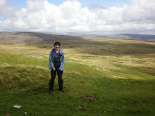
On saturday, I went cross country skiing in Kysuce, from Vychylovka and back. Today, Sunday, I went for a hike in the Terchova area. I thought that there might be less snow, but in fact most of it was still on the ground and it was deep! Today would have been a good cross country skiing day, in fact a group of skiers did pass us and mentioned that they saw bears on the route! So Spring has arrived!
I'm a little stuck at the moment, as what to do in Easter, (the 1st week of April). Which mountains do I go to and what can I do there? I feel like I am in the Twilight Zone, not quite the skiing season, but not yet the hiking season either.
Decisions, decisions.....
An overview of all of the mountains in Slovakia can be found HERE.
Circular walk - easy, (tarmac road, waymarked trail) First leg RED, 2nd leg GREEN
Distance: 15km
Caution: Be aware that logging operations may take place in the forested area.
(1:20 hrs) Centre - Husarik, 3kms on tarmac road - ascent. Caution: traffic. You pass through the village of Butovci, where at the end the road splits in 2, take the left hand road up to the hotel Husarik.
(2:00 hrs) Husarik - Črchl'a, 3kms on paths. Continue past the hotel following the track down for 15 mins, on the way you will see on your left a small chapel. After 15 mins walking, you will see a junction and on your right there is a cross and information post. Take the left hand side path that leads to a small hamlet. As you pass through the hamlet you will see typical Slovak country houses made from wood. Contine straight on, on the way you will encounter another information post with another hiking trail (yellow mark). [Note: This yellow route will shorten the walk by 2 hrs and takes back down to Rieka and back to Cadca]. Carry on following the red mark on the track until you get to open ground, take the left track across the field,(half way there is a telegraph with a waymark). Continue straight until the woods ahead of you where the track veers to the left and ascends once more. Continue along this track, past another modern house on the left, where the track turns sharply to the right. As you ascend the track, ahead of you is another typical Slovak wooden house, where the track goes to the left. Continue to go uphill, past another chapel on your left and further up, another house. Past this house, the track becomes a path and gets steeper. CRCHL'A. At the top, there is another information post and a wonderful viewpoint over the surrounding countryside,where in good weather you can see the Mala Fatras in the distance.
You have now reached the half way point of the walk.
(1 hr) Crchl'a -Kýčera - 3 kms
Now you are joining the GREEN waymark trail, so at the information point, turn back to head back the way you came,but after 20m, join the right hand side path that descends steeply towards the east. Again, you are in open countryside. After 250m, you will see on your right, a picnic area, together with an information board. There is a well in the adjacent small wooden hut. This location has wonderful views to the south.
Follow the track, past a farmhouse to your right until you reach the woods. Continue strainght down through the woods on the main track, (green waymarks), heading due north. Just before the village of
Kýčera, the track road veers to the right. As you pass through the village, you will see on your right, a wooden chapel. Follow the road through the village, then take a left turn at the information post. Walk to the next chapel and the next information post, where the track becomes a path that goes to the right.
Continue pass the small cemetery on your left, descending down into woods once more.
Kýčera - Cadca
Continue down until you reach open fields once more, carry straight on to reach the adjacent woods on the opposite side, take note that the next section of the trail is slightly to the left of the woods, where you will reach the top of the old ski area. Once at the top of the ski area, keep to the right hand side, where the path restarts. This path takes down to a group of flats, where you will join a pedestrain path, go right and continue straight down until you reach Bila supermarket.
The most information about mountains in the Slovak Republic, hiking & cycling routes, accomodation, general information on mountain regions and skiing info.
In English, slovak, German and Polish.
It is a simple and clear website and full of useful stuff!
Maritime Graduate, now a TEFL teacher, but previously a maritime professional for over 10 years.
I enjoy learning languages and I speak French & Spanish. Now I'm learning Serbian/Croatian and of course SLOVAK!